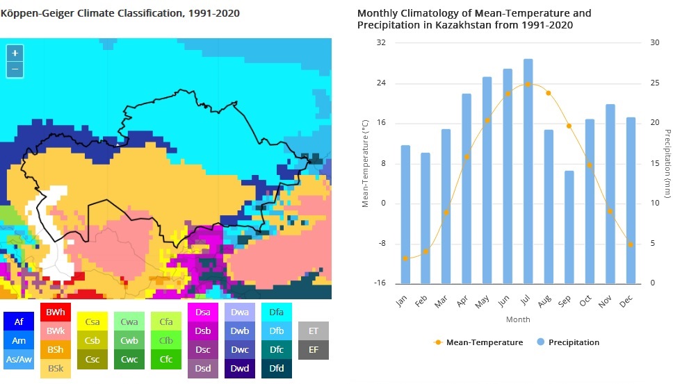
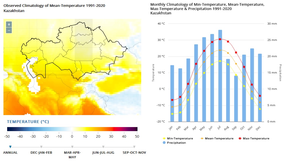
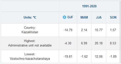
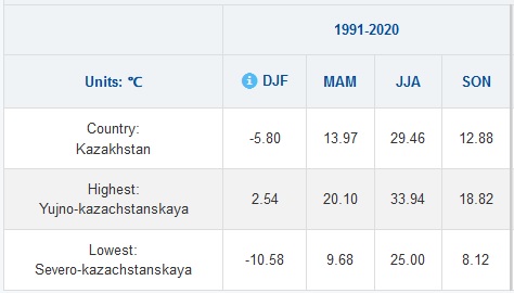
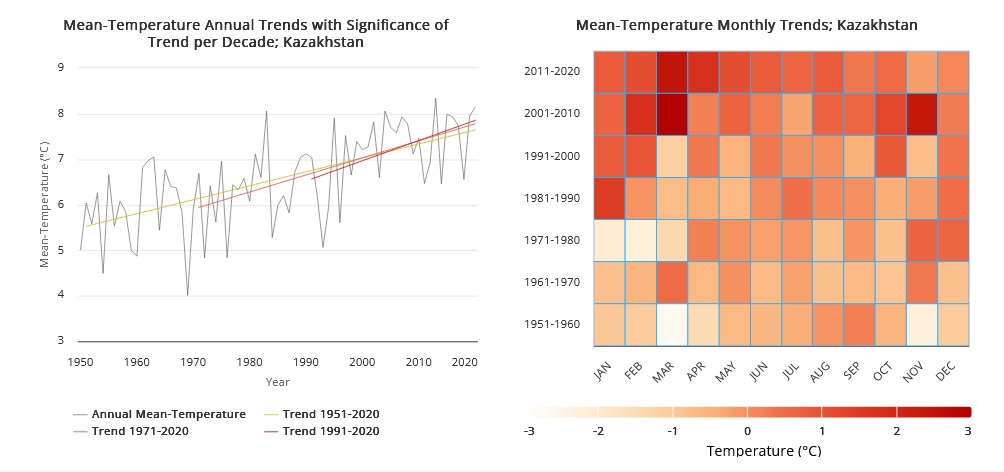
Flat or rolling terrain predominates throughout much of Kazakhstan, with lowlands accounting for one third of the country’s total area and low mountains a further fifth. The exceptions to this topography are the very low-lying areas by the Caspian Sea in the west, and Altay mountains that reach altitudes of 7,000 meters (m) on the eastern border with China and Kyrgyzstan. Kazakhstan experiences an extreme continental climate, with long, hot summers and cold winters. Winter in the north of the country is long and cold – in some years the temperatures reached – 52°C (Nur-Sultan), but there are also thaws up to 5°C. The shortest season in the north is spring, which lasts 1.5 months, while summer lasts 3 months and winter extends from October to April. Snow primarily falls in November but can continue through April. Due to its great distance from the ocean, Kazakhstan has a highly continental climate and large intraday and annual fluctuations in temperature. This means that temperatures in the winter months (December to February) are extremely cold, with national averages between -9°C and -12°C, whereas summers are hot, with average temperatures of 22°C to 23°C in June, July and August. Precipitation is low throughout the year, with average monthly levels of between 14 millimeters (mm) and 30 mm, although flooding can occur during spring due to increased rain and the thawing of winter snow. Temperatures throughout the year vary with latitude in Kazakhstan, with northern areas experiencing much colder winter temperatures than southern areas, and southern areas relatively hot summers. This means that in January and February temperatures in the capital (Nur-Sultan, in the north of the country) can fall to -16°C, while in the most populous city (Almaty, in the southeast) average temperatures remain above -7°C. Similarly, the average temperature in July can vary from 20°C in parts of the north and northeast to 29°C in southern areas near the border with Uzbekistan. Levels of precipitation can vary significantly between climate zones. Desert areas, such as the central Betpak Dala desert and the southern Kyzylkum desert, receive only 100-200 mm of precipitation per annum, whereas steppe areas receive 200-500 mm per year. Precipitation in the foothills and mountains vary between 500 and 1,600 mm per annum.